Română
 Serbian
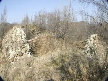
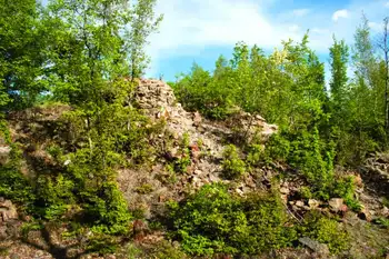
These ruins demonstrate once again the vital role that the defences have played even before the formation of the Romanian Country. Centuries of history are hidden among rocks and buried in walls and expect stories to be told. The fortress is situated on the hilltop Grădeț from where you can easily watch Topolnița Valley, riverbed of Clicevăț as well as the ancient road that passed in the immediate vicinity, leading to the Danube.
The beginnings of the fortress, as well as its history, are a mystery. On the basis of archaeological relics it could be established that the fortress functioned during the thirteenth and fourteenth centuries. From this point start the assumptions. The first would be that the fortress would be born at the beginning of the thirteenth century and then was destroyed by the Great Mongol invasion in 1241.
Another assumption, linked to the name of Luke, the first Ban of Severin mentioned in 1233. Finally, the last hypothesis states that the fortress had been built at the end of the fourteenth century, in the period when the Banat of Severin was owned by the princes of Romanian Country. The only written source is a document issued in 1430 by the Ban of Severin, who inventoried the defensive system of the Banat Fortress and mentioned this fortress as decommissioned.
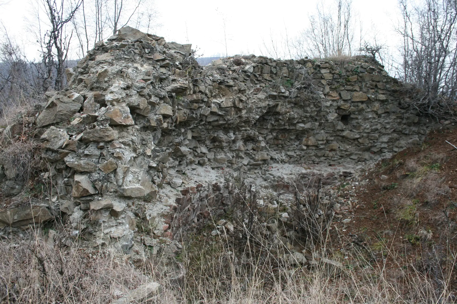
The fortress was built in the shape of an irregular polygon, folded on the hill shape and having an area of one thousand square meters.
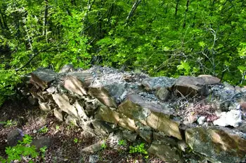
The enclosure wall with a thickness of more than eight feet was built in shale rocks, broken irregularly and caught with mortar. The lower quality of binder negligence of placing boulders induces the idea of a fortification built in hasty due to the very stringent needs of defence.
The gate, located on the south side was surrounded by walls three feet thick. Some parts of the fortress wall were destroyed and the repairs were made most quickly, as the materials and techniques used do not ensure strength.
The fortress has two defence towers. First one, semi-circular had two floors and was located in the northern part of the fortification. Inside the fortress, right in the middle of it, there was a tower-house with circular base, built of stone blocks with large gaps between them. Differences between the walls of the tower and the curtain walls demonstrate that the fortress had two major phases of construction. The history of Grădeț Fortress is shrouded in mystery. Even without precise data showing when the fortress was built, its ruins testify forms of medieval civilization of European type which were also in use by the Romanians.
Fortress ruins represent an important point in the route Hermitage Topolnița- Grădeț Fortress – Păunești Village – St. Dumitru Church- Borovaț Forest.
Access to the trail is from DN 67 up to Tr.Severin- Halânga and DC 7 to Hermitage Topolnița. The route is marked with a blue triangle; blue point (Borovat forest). Following this route can be seen: Săvești Trinity, wooden church of St. Demetrius, banat black pine forest Borovăț. Across the road there are the belvedere points: V. Stirbitei, V. Topolniței, Balvănești Hills.