Română
 Serbian
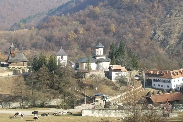
Thematic Route: The Cultural Heritage Route
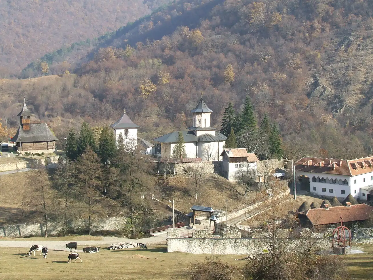
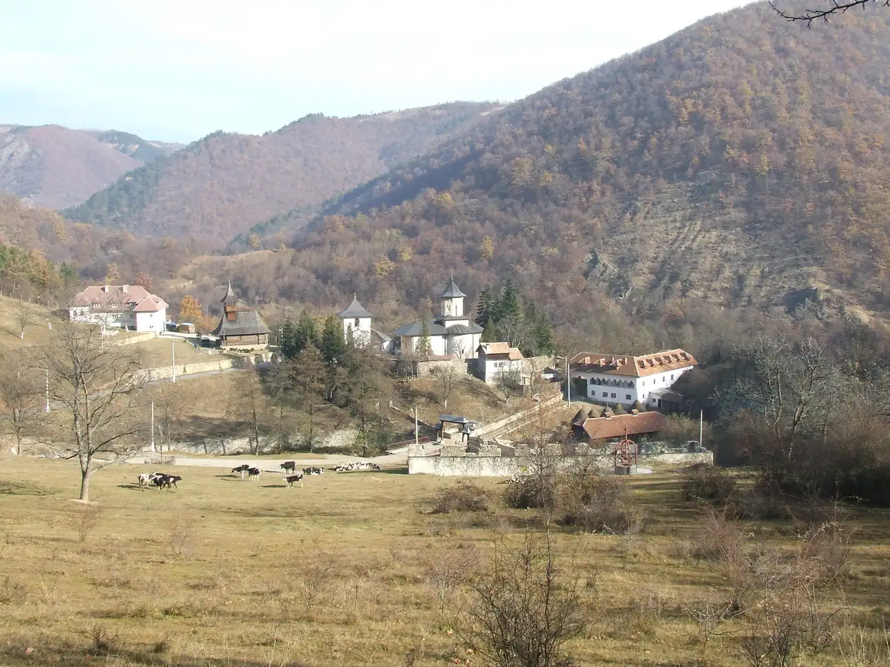
Name of the Touristic Attraction: Topolnița Monastery
Locație: in Mehedinți County, on the valley of the Topolnița River, between the villages Schitul de Jos and Schitul de Sus, in Izvoru Bârzii Commune, Mehedinţi County, 20 km away from Drobeta Turnu Severin
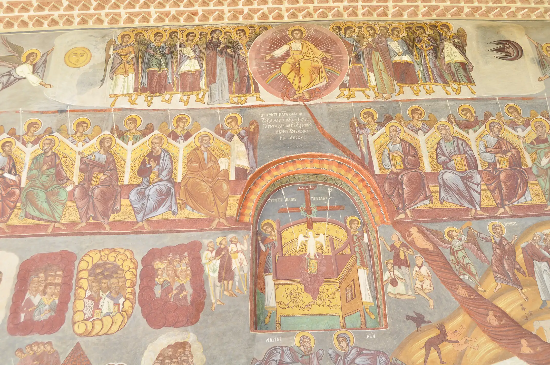
Description: Topolnița Monastery is an ancient Orthodox monastery, enlivened by a monastic monks’ community. The church of the monastery is an old church dedicated to “Saint John the Baptizer”, celebrated on August 29th. It is built in Byzantine style, in the shape of a Greek cross, made of stone and brick.
Legend / Story / Impressions / Recommendations: The legend says that St. Nicodemus of Tismana, leaving from Vodița Monastery to seek a place to build a monastery dedicated to the Virgin Mary, stopped in the valley of the River Topolnița and started building. The construction of the present church dates back in 1646 when, on February 12th, Matei Basarab voivode donated the building to captain Lupu Buliga, for special merits, but in a precarious condition. The new founder will change the patronage of the monastery, from “Saint Michael the Archangel”, set by Nicodemus, to “St. John the Baptizer”. After 1864, due to the secularization of the monastic properties, Topolnița Hermitage was abandoned and the cellars built in 1640 were destroyed. In 1930, The Episcopate of Râmnic and of The New Severin restores the monastic life in the old hermitage. Between the walls of the Topolnița Hermitage, found refuge, Ghiţă Cuţui Olteanul and Simion Mehedinţeanu, captain of Tudor Vladimirescu’s army.
Information and Contact:
Contact: phone: +4 0252-342 565, website: www.manastireatopolnita.ro
The monastery is administered by the Episcopate of Severin and Strehaia:
phone: +4 0252 333 048, +4 0252 333 039,
e-mail: secretariat@episcopiaseverinului.ro
website: www.episcopiaseverinului.ro
Route close to other Thematic Route:
In the area you can also visit:
- Topolnița Cave
- Topolnița Gorges
- Bottomless Lake, Malovăț Commune
- The Fossil Site, Malovăț Commune
GPS Coordinates: lat, long: 44.7598437, 22.608213699999965, elevation: 179 m